Sao Tome FPST - Principe FPPR - Annobon FGAN - Malabo Santa Isabel FGSL
--------------------------------------------------------------------------------------------------------
4 airports bundle ( FGAB,FPPR,FPST,FGSL)
Annobón Airport FGAN (Equatorial Guinea)
------------------------------
Serves San Antonio de Palé, Annobón Island
Elevation AMSL 82 ft / 25 m
Coordinates 1°24′37″S 5°37′19″E GPS : -1.409294, 5.623397
Runways 05/23 1,890m 6,201ft Concrete
Annobón Airport is an airport in San Antonio de Palé, Annobón, Equatorial Guinea.
The airport is west of San Antonio de Palé on the southern island of Annobón. It was inaugurated October 15, 2013 in the presence of Teodoro Obiang Nguema Mbasogo, the President of Equatorial Guinea.
Principe island airport FPPR (São Tomé e principe)
-------------------------------------
Serves Príncipe Island, São Tomé and Príncipe , city of Santo Antonio
Elevation AMSL 591 ft / 180 m
Coordinates 01°39′46″N 007°24′42″E GPS : 1.665038, 7.411830
Runways 18/36 1,750m x 30 5,741 ft ASPHALTE
Príncipe Airport is an airport on the island of Príncipe,located 3 kilometres (2 mi) north of Santo António, the island's capital. It is the only airport on Príncipe and one of the three airports serving São Tomé and Príncipe. It was built in 1968 during Portuguese colonial rule.The only commercial flights available are to São Tomé International Airport in the capital, but private and charter flights are also available.
Unlike the airport in São Tomé, the airport in Príncipe is not certified for Instrument Flight Rules
twr 118.90
São Tomé International Airport FPST (São Tomé e principe)
-----------------------------------------------
Serves São Tomé, São Tomé Island, São Tomé and Príncipe
Elevation AMSL 33 ft / 10 m
Coordinates 00°22′41″N 006°42′44″E GPS : 0.378114, 6.712583
Runways 11/29 2,220x45m 7,283x148ft Asphalt
São Tomé International Airport is a minor international airport located on São Tomé Island, 5 kilometres (3 mi) from the city of São Tomé. It is the main airport serving São Tomé and Príncipe.
Malabo airport FGSL
---------------------------
Serves Malabo, Bioko island, (Equatorial Guinea)
Elevation AMSL 76 ft / 23 m
Coordinates 03°45′18″N 08°42′31″E GPS : 3.758026, 8.716281
Runways 04/22 2,940m 9,647ft Concrete
Malabo Airport or Saint Isabel Airport is an airport located at Punta Europa, Bioko Island, Equatorial Guinea. The airport is named after the capital, Malabo, approximately 9 kilometres (5.6 mi) to the east.
v1.1
1..new airport FGAN build completely from scratch (This airport doesn't exist in MSFS)
2..runway 05/23 is not flat/uneven and at the right elevation (25 m)
3..taxiways, apron and buildings
4..night lighting
5..various objects (windsocks, cars etc...)
6..terraforming
7..add/remove vegetation at the right place
8..add stadium near airport
9..new harbour with boats and containers
10..solar plant near airport
11..new airport FPPR build completely from scratch
12..taxiways, apron and buildings
13..night lighting
14..various objects (windsocks, cars etc...)
15..add villages near airport
16..enhanced city of Santo Antonio (houses and buildings)
17..add/remove vegetation at the right place
18..enhanced FPST (building,lights, various objects...)
19..runway 11/29 at the right elevation (10 m)
20..add/remove vegetation at the right place
21..added mountain ultra-prominent peaks of basalte : Pico Cao pequeno (GPS:0.101761, 6.532894) and Pico Cao grande (GPS:0.117952, 6.566259)
22..enhanced FGSL (building,lights, various objects)
23..added big vegetation areas missing around the airport
v1.2
update all airports
modified runways altitude
modified slope/uneven runways
removed static aircraft (requested by users)
v1.3
various fix
added TOWER frequency 118.90 to FPPR


2 days ago
TymeBandit
3 days ago
Tinh1000000
3 days ago
gmazzei55
3 days ago
timot75
I suggest you may use :
https://flightsim.to/file/392/tree-height-modification-for-mfs2020-shorter-realistic-trees
3 days ago
timot75
7 days ago
lscism
11 days ago
3 days ago
timot75
BostonElf
26 days ago
simbrad66
26 days ago
simbrad66
5 months ago
Condor7777
Works fine for me. The only issue I found was that Moh Creek elevation was more like 600 feet. Tricky little airstrip.
3 years ago
you are right
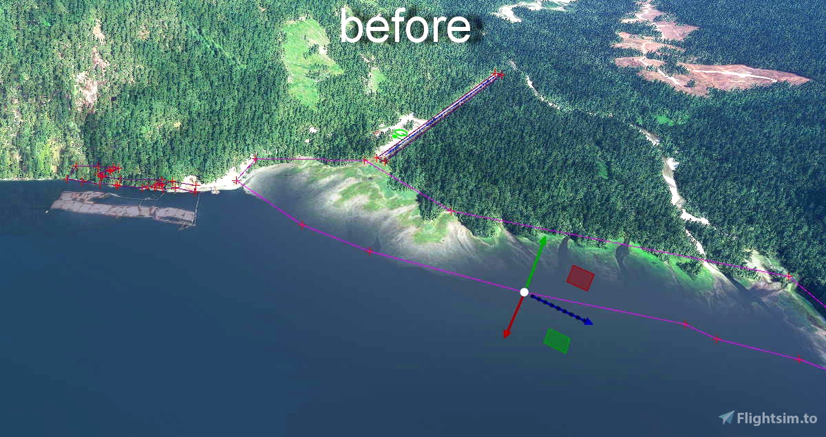
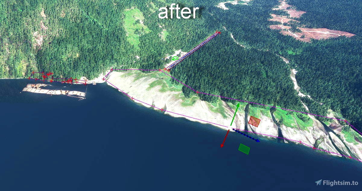
I now fixed the airfields elevation
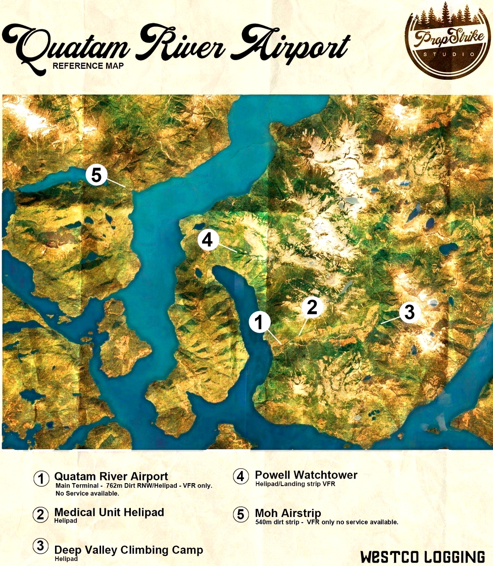
Quatam River Airport Elevation 115 ft AMSL (35m)
Moh Creek Airport Elevation 577 ft AMSL (176m)
thanks for reporting
3 years ago
timot75
archaicpariah
This did not work for me
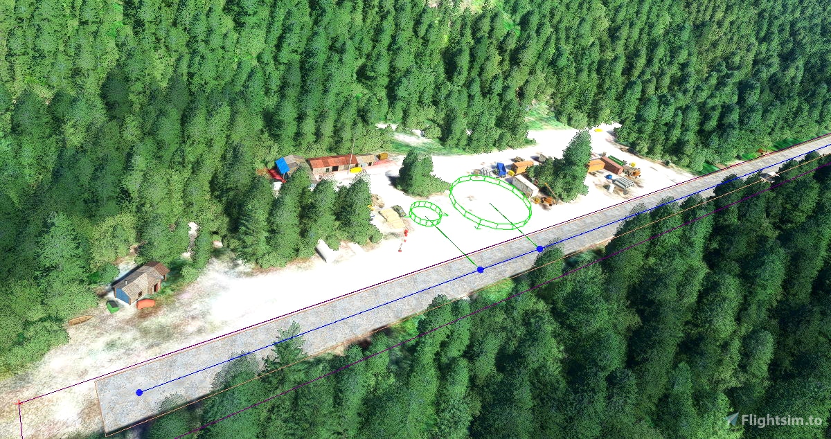
large no of lumps and bumps at Quatam strip-Moh Creek very basic
My setup?
xxd09
3 years ago
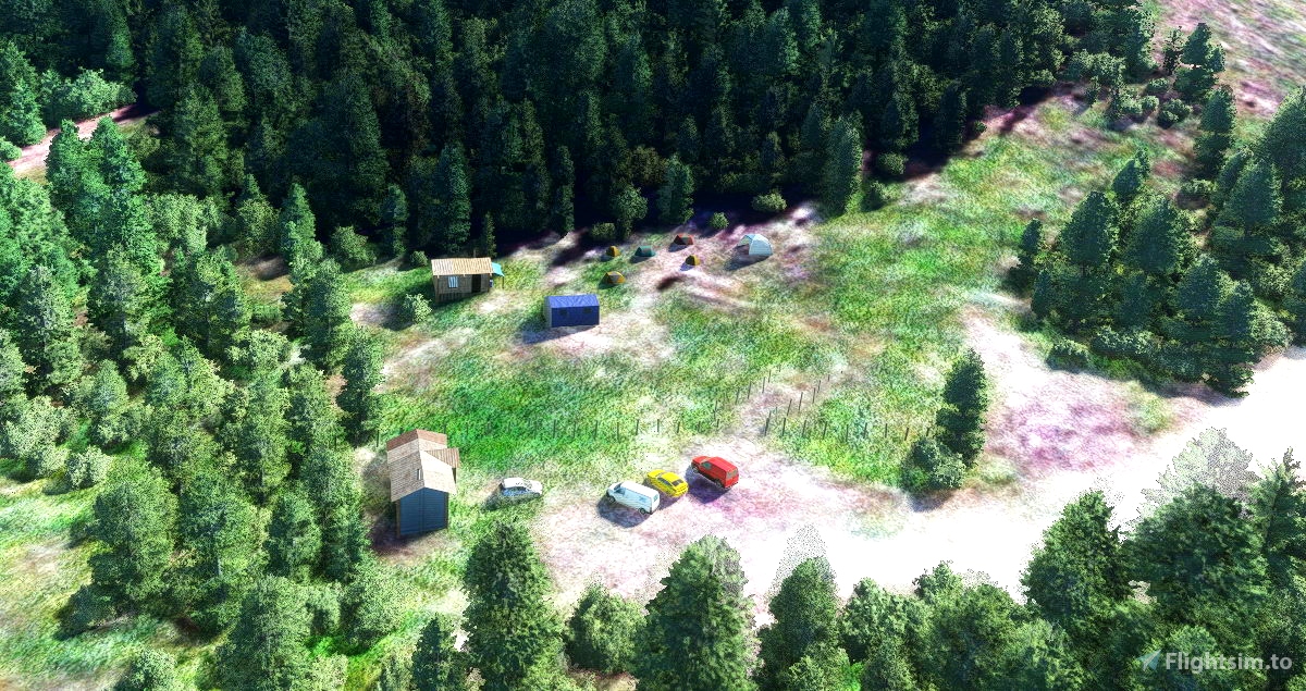
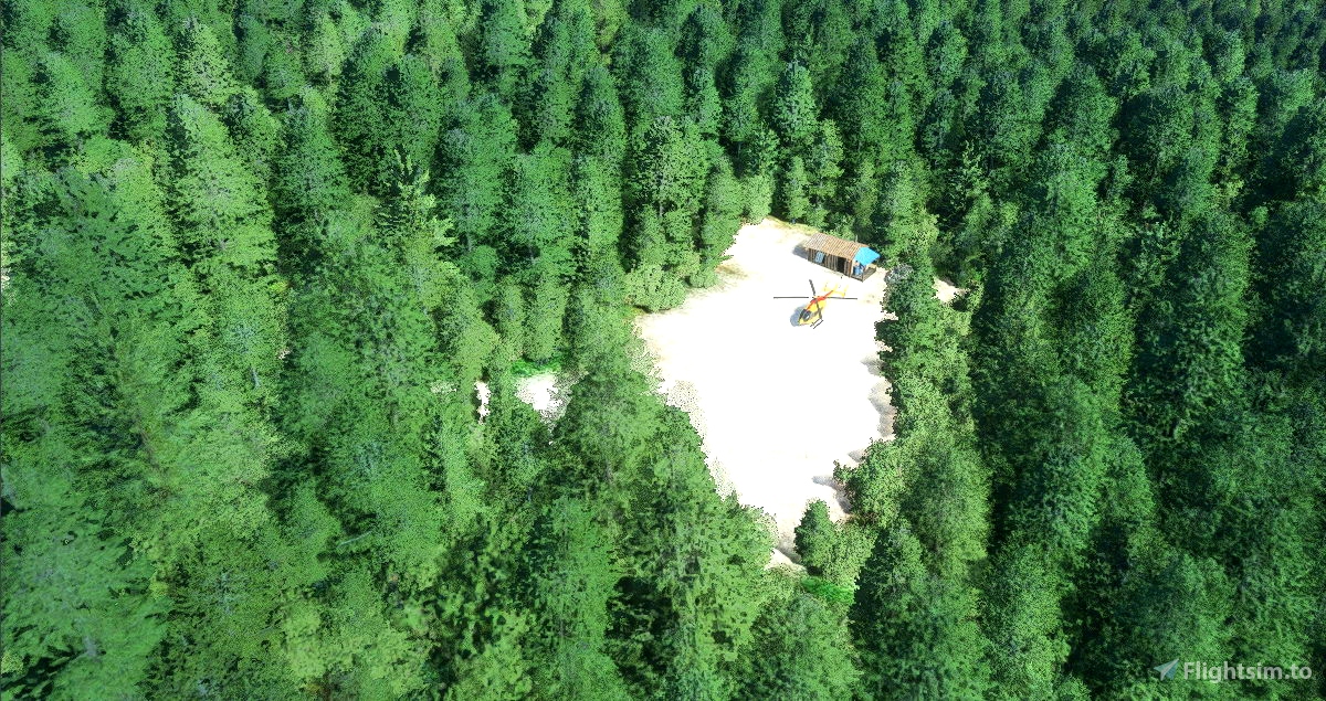
they are both bush airfields so I did not flatten the runways
I just added objects, and remove some trees and water
I tried to to leave them as realistic as it should be
I have been said those airfield are in a pretty bad condition and quite hard to land on
best regards
3 years ago
timot75
xxd09